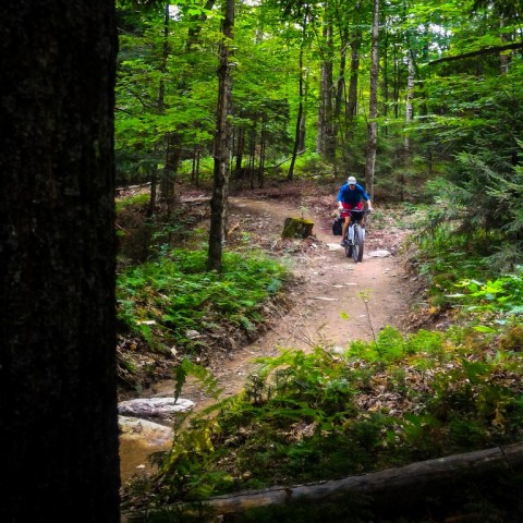
Riding the XVT (Cross Vermont Bikepacking Route): Part 2

If you haven’t read Riding the XVT: Part 1, you can read it here.

   Before Jeff and I finished the northern part of the XVT, I was already making plans to ride the southern section. Jeff was unable to join me, but Dan, my close friend and 4-season adventure partner was chomping at the bit to ride it, we just needed to make the time. Neither of us had any intentions of setting a record, but we planned on moving quicker than a touring pace while still taking some breaks and getting eight hours of sleep every night. On short notice we managed to find 2½ days in our schedules that matched up, and with an offer from Jeff to drive us to the start on the Massachusetts border, we were off.

Continue reading Riding the XVT (Cross Vermont Bikepacking Route): Part 2

Riding the XVT (Cross Vermont Bikepacking Route): Part 1

   I was back from Alaska for only a couple of days when Jeff, who I rode the Great Divide Mountain Bike Route with last year, mentioned he wanted to ride the XVT and he wanted to leave that weekend. Perfect, enough time to unpack, repair, and repack my gear, with a little time to research the route. The XVT, or XVtBkPkRte as it’s also referred to, is a 300 mile long bikepacking route that runs the length of Vermont, from Whitingham on the Massachusetts border to Derby on the Canada border.

Continue reading Riding the XVT (Cross Vermont Bikepacking Route): Part 1

The Past Few Weeks

Fargo

Two weeks to go before I’m back on the road. I have a flight to Phoenix Arizona on December 4th and from there…… I’m still deciding. My time back home, while a bit stressful, has also been enjoyable and is something I needed to do. It’s been many, many years since I’ve spent this much time with my family.

Continue reading The Past Few Weeks

House is empty, bike is shipped – It’s finally here

Things have been kind of busy lately, with more work hours than fun hours, but the finish line is in sight. Next Thursday, September 5th, I’m flying to Phoenix, Arizona and the start of a new chapter. Most of what I own has been sold, given away, or put into indefinite storage and this morning, I loaded my bike and gear onto a trailer headed to Douglas Arizona and will meet up with it next week. It was a lot to tackle in a short amount of time.

I’ll admit it, I don’t have much of a plan. I have two weeks of work left once I arrive and I will be working in Fronteras Mexico for that time. After that….. Ride the Arizona Trail, tour around Mexico, tour around the Desert Southwest for a while, or maybe something I’m not even thinking of yet, I don’t know. I have a one way ticket, so I know I’m not flying back. Eventually I’m heading to South America, but maybe I’ll head north first. Once I look at some maps, I’ll get an idea.

Anyway, the commute to work this morning was great. I caught the sunrise with a perfect foreground view. I’m going to miss this ride in the morning.

iPhone Sunrise

Foggy RidePhotos were taken with an iPhone 4, not the best image quality but it’s what I had.

One photo a day, I’ll give it a go

Photo a Day 6/22/2013

I know many have done this before, one photo a day for a year, but I’ve never really been driven to try this until now. Photography, for me, is something I really enjoy when I travel, but when I’m surrounded by the familiar, the drive is lost. I have a camera on me much of the time, in the form of my iPhone, so I just need to make the time. I’m not going to post most of the photos here, but I’ve started a Photo a Day set on my Flickr page and that is where they will be.

I rode the Goshen Road to Middle Road, back on River Road, back home on Goshen Road loop today (on page 33 of Delorme’s Vermont Atlas and Gazetteer) and that is where this photo was taken. About 36 miles and 4,000 feet of elevation gain, and with the exception of 3 miles or so, all on dirt. Rural Vermont riding at it’s best.

Loop through Plymouth Vermont

This past Saturday I awoke to a sunny sky, light wind and a meeting time of 6:00am. My friend and fellow Ripton bike commuter Jeff was riding down to Springfield, VT. to meet his traveling brother and asked if anyone was interested in riding along for some of the way. It was easy for me to say yes and and as a bonus, our friend Noah was going to ride as well. Noah, Jeff and I have been planning a good ride together for years, but have never been able to make it happen.

After rendezvousing in my driveway, we started off with a climb up and over Rt. 125 and a quick trip down Rt. 100 for breakfast at the Rochester Cafe and Country Store.

I highly recommend The Rochester breakfast, it’s a lot of fuel for a big ride.

With stomachs full and a light tail wind we make great time down Rt. 100 and took River Road, the short dirt cutoff, to Rt. 4.

The plan was for Noah and I to ride south to Rt. 100A and make a loop back to Ripton, while Jeff continued on to Springfield. Noah had a return time of around 1:30pm and the riding was flat, so this didn’t seem like a problem.

We hit the country store that has been closed since Hurricane Irene, just before the 100A intersection, around 10:15am and bid Jeff a bon voyage. This is where the riding changed. Turning onto Rt. 100A the first big climb appears. I’ll admit, I tend to look at directions on a map and ignore the contour lines. It adds a bit of spice to my rides. I also missed the point on the map referring to Plymouth Notch about 1 mile up Rt. 100A, so this climb was a surprise. The grade was pretty consistent, the views were great and there was no traffic, a perfect road. We rode past “Silent” Calvin Coolidge State Park and many well kept country homes. The decent was gradual down to Rt. 4 where we turned east and picked up North Bridgewater Rd. to take us to Rt. 12.

North Bridgewater Rd. is another perfect Vermont cycling road. No traffic, great views, smooth dirt and another steep climb with many false summits. Some people pay money to ride roads like this.

At this point we realized time was getting away from us (shocking) and we decided to take more direct route home. After a fast and smooth dirt decent we intersected Rt. 12 and took that north to Rt. 107.

From there we rode Rt. 107 to Rt. 100 and traced our steps over East Middlebury Gap (past a large bull moose near the top of the gap) back to my house.

Until I can find a better online mapping site (suggestions welcome), Google Maps will need to suffice. Great company, 107 miles and a bit of climbing makes for a great ride.